Strategic urgency
U.S. law defines critical minerals as non-fuel commodities essential to economic or national security with vulnerable supply chains.
Energy Act of 2020 (DOE / CRS)
Solution • SaaS workspace
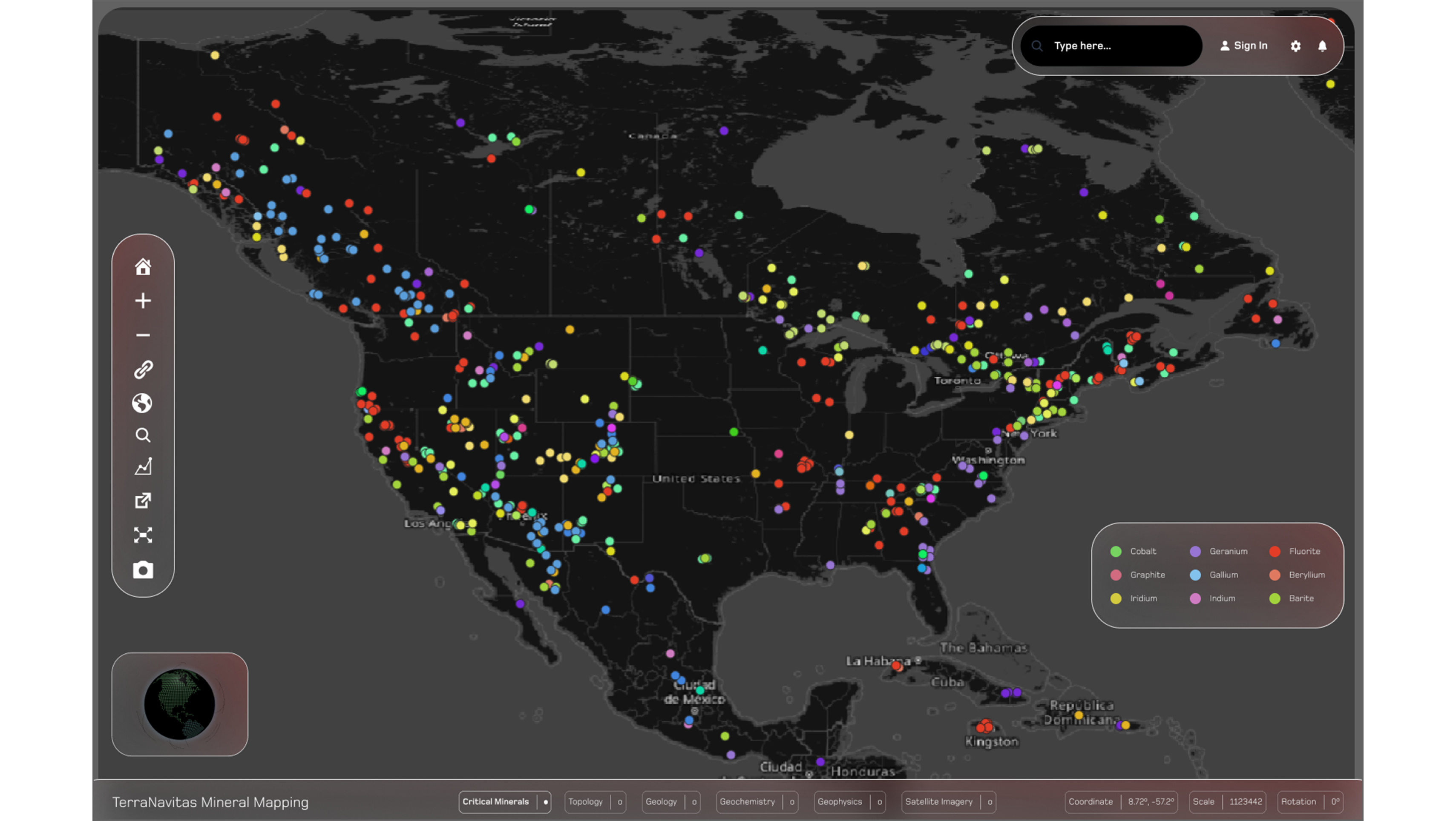
An AI-accelerated platform that harmonizes massive public + proprietary geoscience datasets and turns them into defensible exploration hypotheses, ranked targets, and exportable GIS-ready layers — built on the same data integration backbone as ODIS.
Why it matters
“Critical minerals” are formally defined in U.S. policy, supply chains are tightening, and the public geoscience corpus is enormous—but underutilized without serious data engineering and AI.
U.S. law defines critical minerals as non-fuel commodities essential to economic or national security with vulnerable supply chains.
Energy Act of 2020 (DOE / CRS)
In IEA climate-driven scenarios, lithium demand is projected to grow by over 40× by 2040 (fastest among major minerals).
IEA — Critical minerals report
USGS hosts petabyte-scale Earth observation and national-scale geoscience datasets (Earth MRI, USMIN, geochem, geophysics) that require harmonization to be decision-ready.
USGS EROS / Mineral Resources portals
Sources: DOE on Energy Act definitions ; CRS summary of statutory criteria ; IEA projection (SDS) for lithium demand growth ; USGS EROS archive size ; USGS Earth MRI and Mineral Resources data portals .
Workflow
A clean, repeatable loop: data → signals → targets → defensible outputs.
Bring in public + proprietary layers: remote sensing, geophysics, geochem, structural + topo, drillhole logs.
Normalize schemas, georeference, unify vocabularies, and make the stack queryable (schema-on-read).
Generate and compare prospectivity surfaces, alteration indicators, and anomaly stacks.
Turn hypotheses into ranked targets, reports, and GIS-ready exports for field validation.
Data + AI core
The platform is designed to integrate multi-modal datasets (geochem, geophysics, remote sensing, topo/structural, drillholes) and run exploration-specific AI workflows on top. For interoperability, it targets OGC map services and REST handoffs.
Schema-on-read, queryable layers, fast filters, and project workspaces designed for continent-scale stacks.
Domain models aimed at reducing early-stage cost and cycle time (with uncertainty-aware outputs).
Make your work portable: export layers, targets, and technical packages for partners, regulators, and field teams.
Data coverage
We design around major public programs like Earth MRI, USMIN and national geochemical databases, and we aim to keep ingestion modular so your proprietary layers can drop in cleanly.
Millions of assays across rock/soil/sediment/water and concentrate datasets — ready for spatial joins and feature engineering.
Magnetics, gravity, radiometrics and more — unified into a consistent spatial stack for anomaly screening.
Multispectral + hyperspectral imagery pipelines for alteration, structure, and surface mineral indicators.
If you share a region + commodity focus, we’ll provide a coverage view (datasets, vintages, resolution) and the recommended workflow to get to drill-ready targets.
Enterprise-grade design
For GIS interoperability, we align with OGC web services (WMS) and common enterprise GIS patterns (e.g., ArcGIS support for OGC services).
Microservices with elastic GPU/CPU execution paths for ingestion, tiling, and model runs.
Encryption in transit/at rest, RBAC patterns, and paths toward SSO and sovereign hosting options.
OGC-WMS + REST patterns for linking to ArcGIS/QGIS and downstream 3D/geo modeling workflows.
Ideal users
Greenfield and brownfield plays—screen targets faster and defend hypotheses with a consistent evidence stack.
Secure upstream offtake—compare regions, risks, and signals with a transparent pipeline to targets.
Accelerate strategic assessments—turn public archives into structured, queryable, comparable outputs.
Screen deal flow—rank upside and surface the “why” behind targets using audit-friendly artifacts.
Also from TerraNavitas
Request access
Share a region + commodity focus. We’ll return a coverage view, an initial workflow, and a demo built around your thesis.
Context: global energy investment is projected to reach $3.3T in 2025—supply chains and mineral availability matter more than ever.